
· By Amanda Stelter
Trail Reviews: Mt. Mitchell - Pisgah National Forest, North Carolina

Trail Reviews: Mt. Mitchell – Pisgah National Forest, North Carolina
Distance: 11 miles
Elevation: 3,710-ft
Towering high along the Black Mountain range lies the tallest peak east of the Mississippi river, Mt. Mitchell. Just a little over an hour north of Asheville, NC lies the trailhead to Mt. Mitchell in the Pisgah National Forest. If you're looking for a peaceful with added bragging rights, then look no further than Mt. Mitchell.
Just off the Blue Ridge Parkway is Mount Mitchell State Park, a lovely park and campground featuring trails for all skill types, or even just a place to and relax. If you're not looking to hike to the top of Mt. Mitchell, you can drive up near the summit and soak in the view without hardly breaking a sweat.
The trail begins at the Black Mountain campground off of South Toe River Road. Take the bridge across from the parking lot, follow the trail and begin your ascent. Approximately 5.6 miles of trail will take you up through the thick Balsam forest that offers the ultimate peace and quiet.
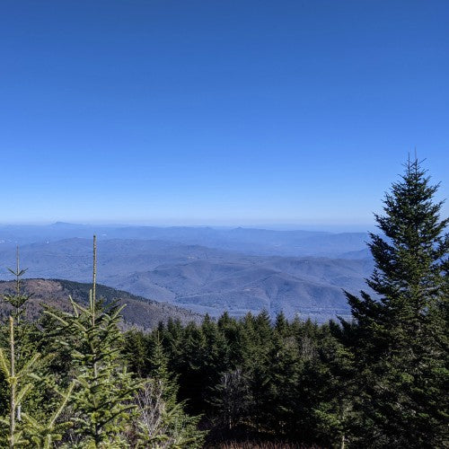
From the parking area at the summit, a short 10-minute hike will take you directly to the summit where you can view sweeping panoramic views from the observation deck. Clear skies offer stunning views of Grandfather and Table Rock off in the distance. If you're willing to go the extra mile, or 3 miles, Mt. Craig is the second highest peak east of the Mississippi and can be knocked off in the same day!
Despite this trail being a bit long, the elevation gain is gradual and levels out as you approach the summit. It is important to note the terrain can be a bit technical with the trail featuring lots of exposed roots, rocks, and mud that require careful footing.
Whichever route you choose to take to the summit, you won't be disappointed by the breathtaking landscape and views at the top!
