
· By Amanda Stelter
Trail Reviews: Blue Lakes Trail to Blue Lakes Pass - Ridgway, CO

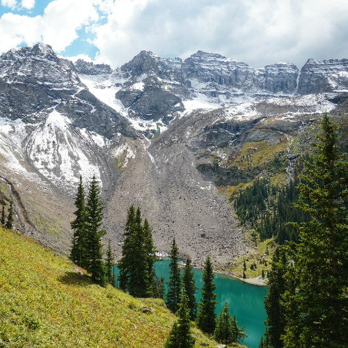
Lower Blue Lake (Photo credit: Amanda Stelter)
Trail Reviews: Blue Lakes Trail to Blue Lakes Pass – Ridgway, CO
Distance: 6.3-11 miles
Elevation: 1,590-3,650 ft
Have you ever been so in awe of a view, your mind went completely blank and no words could be formed to describe what lay before you? That is precisely what happened to me as I sat atop Blue Lakes Pass and gazed outward to a series of peaks looming high above Yankee Boy Basin below. If you’re up for a challenge and seeking perspectives from high above, then pack you bag, and get to this trailhead ASAP.
To get to the trailhead from Ridgway, CO, take Highway 62 and turn onto Dallas Creek Road (CR 7). You will then drive 8.5 miles along a gravel road to the trailhead. Despite being off road, any 2WD vehicle can make the drive, but be slow and cautious of potholes, larger rocks, and washboard ruts riddling the trail. You will want to take the drive slow regardless of your rig, as the views of the distant mountains and vibrant Aspens all around are a remarkable sight worth admiring.
Parking at the trailhead is fairly limited, but there were cars parked alongside the road leading to the trailhead. It would be best to arrive early to snag a spot. The trail begins just beyond the locked gate at the end of the main road. A slow and gradual incline through the dense Uncompahgre National Forest will take you alongside a gurgling river up closer to the mountains.
The beginning of the trail features relatively steep inclines and a couple switchbacks. Overall, the trail leading up to Lower Blue Lake features a 1,590-ft elevation gain over the course of 3.5 miles. It is the first and largest of the three lakes along the trail and rests at 10,980-ft.

View of Upper and Middle Blue Lake (Photo credit: Amanda Stelter)
From Lower Blue Lake, the trail begins to climb up and up. The section of the trail leading to middle lake is breathtaking as it leads you alongside the mountain with views of lower blue lake far below. Once you reach middle blue lake, continue to press on for a little over a ¼-mile to reach Upper Blue Lake. The panoramic views of the surrounding peaks like Mt. Sneffels to the left, Dallas Peak straight ahead, and Gilpin Peak facing the south, from Upper Blue Lake are truly remarkable.
In the summertime you can expect to be embraced by fields of wildflowers like blue columbine, purple larkspur, lupine, paintbrush, and countless more. I arrived just outside of the peak wildflower season, but the best time to view these colorful beauties is mid-July through mid-August.
Those who are content with having reached the upper lake can relax and turn back around to follow the same trail back to the trailhead; however, those who are seeking to press a little further can make the final 1,280-ft push to Blue Lakes Pass and even summit Mt. Sneffels standing at 14,150-ft. I can’t recommend making this last push enough.

Blue Lake Pass (Photo credit: Amanda Stelter)
Steep switchbacks will snake you up the side of the mountain to the top of Blue Lakes Pass to give you unbeatable views of the mountain range from atop! Gaze forward to meet your eyes to the mountain and downwards to gain a new perspective of the upper and middle lake. Take a few moments to soak it all in before choosing to continue on to summit Mt. Sneffels, hike along the ridgeline a bit, or turn back around to make your way back to the trailhead.
Those looking to summit Mt. Sneffels should be aware of the strenuous conditions of the summit. From the top of the pass, the trail is poorly marked, and it is advised that you have a GPS. The trail first takes you down and around the backside of the mountain before forcing you to climb the last 1,000-ft or so straight up to the peak. This last push to the summit is a scree climb and should be approached carefully.
At whatever point you choose to push to, you can turn back to the trailhead with a full heart from stunning mountain and lake views that will have you reeling all the way back to the car.
