
· By Amanda Stelter
Trail Reviews: Ice Lake Basin Trail - Silverton, CO

Trail Reviews: Ice Lake Basin Trail – Silverton, CO
Distance: 7.5-10 miles
Elevation: 3,200 ft
Let me begin by saying, this is one of the most beautiful and rewarding hikes I’ve ever had the privilege of trekking. I cannot more highly recommend this trail to anyone in the Durango/Silverton area, it is a true gem of the San Juan mountains.
The trailhead is roughly 20 minutes from Silverton, CO and can easily be reached by any 2WD vehicle. From Silverton, drive 2 miles along Hwy 550 until you reach County Road 7 just off to the left of the highway (marked for South Mineral Campground). Follow the gravel road for 3.5 miles until you reach the small parking lot at the trailhead. It is important to note the lot fills fairly quickly, but there are many pull-off spots to park along County Road 7 as well in the event the lot is full when you arrive. Be mindful of the signs indicating no parking zones, as well as refraining from parking in the meadows.
I feel it necessary to note right off the bat that this is a strenuous trail, but is absolutely possible by anyone determined to experience all the beauty this trail holds! The trail begins in South Mineral Valley followed by steep switchbacks and stretches of trail that snake up to the lower, then upper basin. Walking through the forest, the trail features multiple breaks in the dense coniferous trees to reveal stunning views of the surrounding mountains. Almost immediately, you will encounter the first series of moderately steep switchbacks taking you up and up through the forest.

Lower Ice Lake Basin
Photo credit: Amanda Stelter
As you break from the tree line, pass through meadows of wildflowers, and cross the remnants of old Golden Gate mine, you will begin the more strenuous portion of the hike to the Lower Ice Lake Basin. As soon as you break from the forest, the lower basin will reveal sweeping panoramic views of the surrounding mountains and a vibrant green meadow bursting with flowers and gentle alpine streams. From this point onward you will be exposed to the elements as there will be no trees to shield you from the sun, wind, and potential afternoon thunderstorms.
At around 2.2 miles and at nearly 11,400-ft, you will reach the Lower Ice Lake Basin. The trail through the basin is relatively flat and offers a nice break from the steep switchbacks just climbed…but don’t get your hopes up, it only goes up from here!
From the basin, looking straight on you will see the trail sharply incline up the side of the mountain and steep switchbacks are hidden from view beyond there. As you near the end of the basin, crossed a few streams, it is time to make the climb up. This next section of the trail leading to Upper Lake Basin is quite steep and gains more than 650-ft in a little over half a mile. As steep as the trail may be, as you begin to ascend, the views of the basin below and mountains all around are truly incredible.
At around 4 miles you will reach the Upper Lake Basin. This basin is home to thousands of wildflowers during the peak growing season of July-August. I just missed this season having hiked it in September, but from research, the variety of wildflowers include alpine forget-me-nots, sky pilot, purple fringe, columbine, chiming bells, neon pink paint brush, and much more!

Photo credit: Amanda Stelter
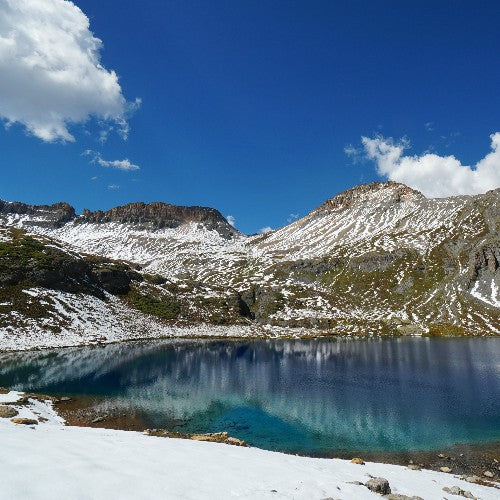
As you near the end of the series of steep switchbacks and climb over the final edge of the mountain, a short stretch of trail will lead you to the eastern shore of Ice Lake. With the sun shining on the lake, it is easily one of the bluest lakes I have ever laid eyes on. The water on the shoreline displays a light blue and gets progressively deeper as you look deeper into the lake. Surrounding the lake are jaw-dropping views of multiple 13-ers such as Fuller Peak, Vermillion Peak, Golden Horn, Pilot Knob, and Grant Peak.

Island Lake
Photo credit: Amanda Stelter
From Ice Lake you can extend your trek for a fuller experience by heading northeast to Island Lake, or south to Fuller Lake. I hiked to Ice Lake, continued about ½ -mile west of the lake to view the lakes from halfway up a mountain, then hiked to Island Lake before beginning my descent. In total, I clocked in at around 11.5-miles for the whole trip.
Take some time to fully appreciate and enjoy the astounding views, as well as give yourself a pat on the back for you efforts! Begin your descent the same way you came or by taking the trail to Island Lake that loops back to the familiar trail you originally ascended.
